|
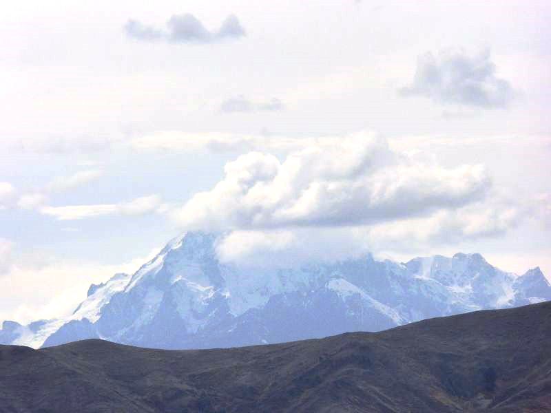
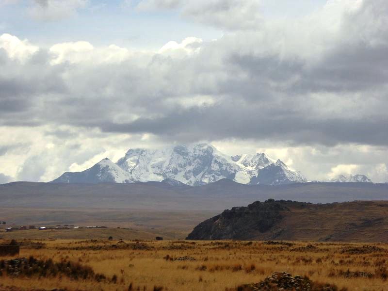
Huayna Potosí is one of the most famous
mountains in
Bolivia and is part of
the Andean mountain range.
It is located just to the north of the city of
La Paz and is one of
the highest mountains that can be climbed by relatively inexperienced
mountaineers. Known for its striking beauty and accessible climb,
Huayna Potosí is a
popular destination for trekkers
and
mountain climbers looking to experience the thrill of
high-altitude climbing.
Key Features of
Huayna Potosí:
-
Elevation:
- Huayna Potosí stands at an
impressive 6,088 meters
(19,974 feet) above sea level, making it one of the
tallest peaks
in the Cordillera Real
mountain range. It is often considered one of the more
approachable
high-altitude climbs, attracting both beginner and
intermediate mountaineers.
-
Climbing Accessibility:
- Huayna Potosí is known for
being one of the most
accessible 6,000-meter peaks in the world. The
normal route to
the summit is technically not too difficult, and many climbers
attempt the summit with
minimal technical
climbing experience. However, it still requires serious
preparation and awareness of high-altitude conditions.
-
Guides and
equipment rental
are widely available in
La Paz, and
most climbers take a
two-day tour to climb the mountain. Climbers typically
spend one day trekking to the
base camp (at
around 4,700 meters) and another day summiting the peak.
-
Climbing Routes:
- The most popular route to
the summit is called the
normal route
and involves a glacial
climb. The climb is demanding, requiring a good level
of fitness, glacier
experience, and the ability to cope with high-altitude
conditions.
- The ascent involves
ice climbing
and crevasse crossings,
so it’s important for climbers to be equipped with
ice axes,
crampons, and
ropes.
Professional guides will lead climbers safely and help with the
technical aspects of the climb.
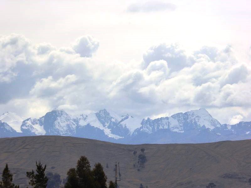
- The summit offers stunning
views of the surrounding mountains and
La Paz,
making the effort worthwhile for those who make it to the top.
-
The Base Camp:
- The
base camp for
Huayna Potosí is typically located at
4,700 meters
(15,420 feet), which is a common point for acclimatization
before attempting the summit. Climbers usually spend a night at
base camp before continuing the climb.
- The base camp is
accessible via a 3-4 hour
trek from the
starting point, and from here, climbers can begin their summit
attempt. Many climbers take the opportunity to rest and adjust
to the altitude before pushing higher.
-
Acclimatization:
-
Acclimatization
is a crucial part of climbing Huayna Potosí. Given the
mountain’s high altitude, climbers are encouraged to spend time
at the base camp and even higher elevations to reduce the risk
of altitude sickness.
It’s essential to give your body time to adjust to the reduced
oxygen levels.
- Most climbers coming from
La Paz (which
is already at a high altitude of about
3,650 meters)
should be careful to acclimatize properly before attempting the
climb to ensure the best chances of success.
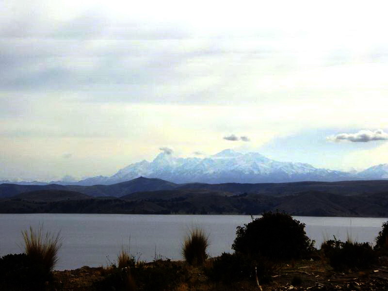
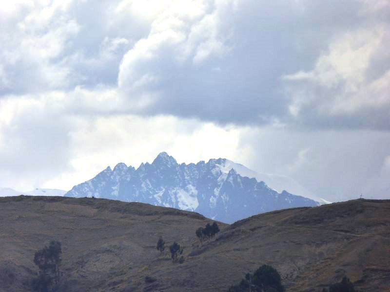
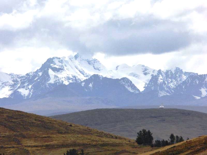
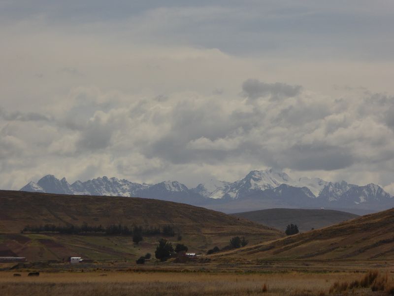
-
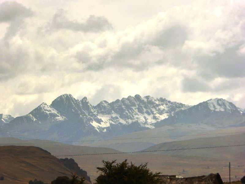
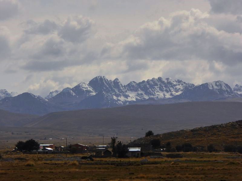
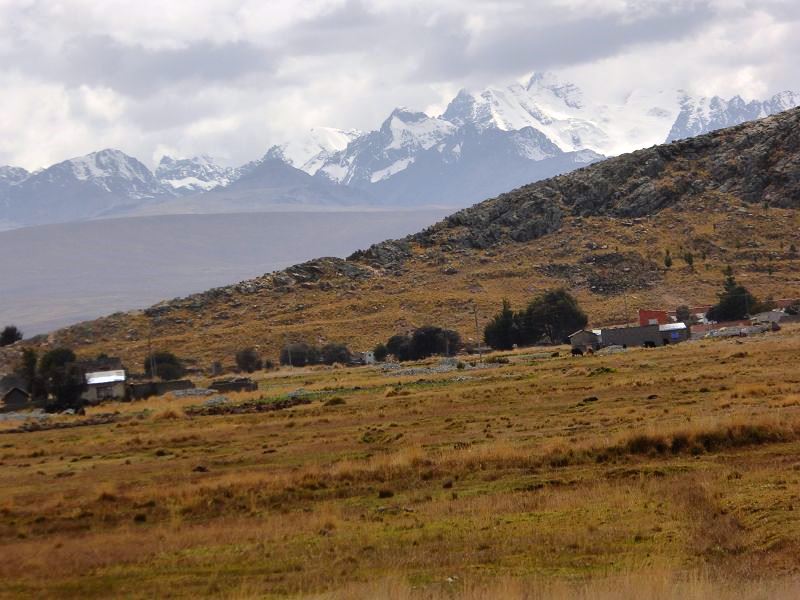
Scenic Beauty:
- The views from
Huayna Potosí
are breathtaking, with panoramic vistas of the surrounding
Cordillera Real
mountains and the
altiplano (high plateau) below. On a clear day,
climbers are rewarded with views of nearby peaks such as
Illimani and
Mururata, and
they can also see La
Paz in the distance.
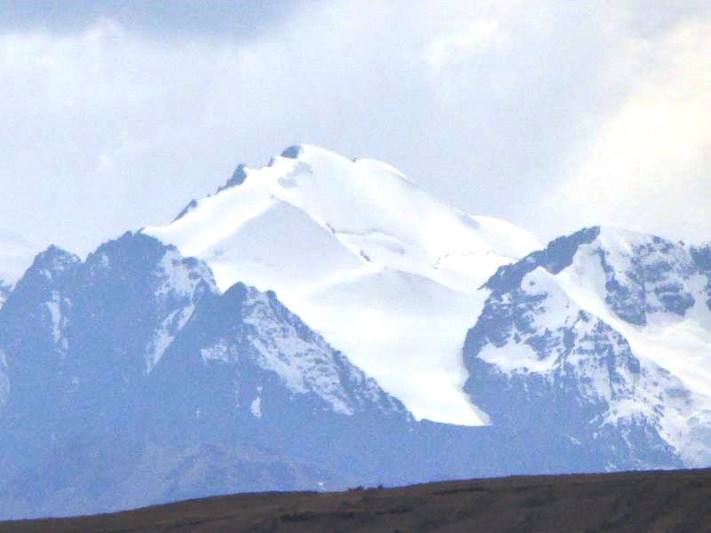
- The glacier and
snow-covered slopes of Huayna Potosí provide an iconic Andean
mountain landscape, and the summit gives an unparalleled view of
the surrounding
snow-capped peaks and
mountain ranges.
-
Difficulty and Experience
Required:
- While
Huayna Potosí
is considered an achievable summit for climbers with limited
experience, it still presents challenges due to its altitude and
the technical nature of the glacier climb.
- Most climbers need to be
in good physical condition and should be prepared for long days
of hiking and climbing in extreme cold and thin air. Even though
it's not the hardest climb in the world, the
altitude can
still make it dangerous for those who are not properly
acclimatized.
-
Best Time to Climb:
- The best time to attempt a
climb of Huayna Potosí
is during the dry
season, from
May to October. During this time, the weather is
generally clear, and conditions are better for climbing.
-
November to April
is the rainy season, and the climb may be more challenging due
to the possibility of heavy snow or rain. Some routes may become
too dangerous to climb during the rainy months.
-
Nearby Attractions:
-
La Paz: The
capital city of Bolivia is the main point of departure for
climbing Huayna Potosí. From here, you can also explore the
Valle de la Luna
(Moon Valley) or take part in other adventure activities like
mountain biking or hiking.
-
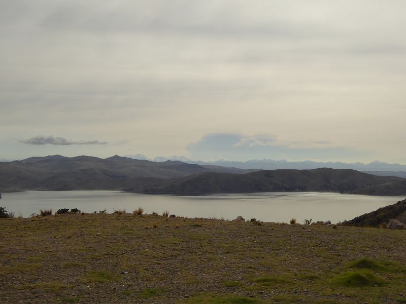
Lake Titicaca:
About a 3-4 hour drive from La Paz,
Lake Titicaca
is the highest navigable lake in the world and offers beautiful
landscapes, traditional communities, and opportunities to visit
Isla del Sol
and Isla de la Luna.
-
Chacaltaya:
Another high-altitude
mountain near La Paz, which used to have the world’s
highest ski resort. The
Chacaltaya ski resort
is no longer operational, but the
mountain and views
are still worth exploring.
Practical Information for Climbing
Huayna Potosí:
-
Guides and Tours:
-
Guided tours
are highly recommended for anyone attempting the climb.
Experienced guides can provide the necessary equipment, ensure
safety during the ascent, and offer advice on handling
high-altitude climbing.
- Many companies in
La Paz offer
two-day expeditions
that include transportation, accommodation at base camp, meals,
and the necessary climbing gear.
-
What to Bring:
- For climbing Huayna
Potosí, it’s important to pack the right gear, including
warm clothing,
mountain boots,
gloves,
sunglasses,
sunblock,
headlamp,
ice axe,
crampons, and
a rope. While
guides provide many of these items, it's a good idea to bring
your own personal gear for comfort.
- It's essential to carry
water and
snacks to
keep your energy up while climbing, as the trek can be
physically demanding.
-
Altitude Sickness:
-
Altitude sickness
is a risk when climbing mountains over 4,000 meters. Symptoms
can include headaches, dizziness, nausea, and fatigue. Make sure
to take the time to acclimatize properly and drink plenty of
water to stay hydrated. If you feel symptoms of altitude
sickness, it’s important to descend to a lower altitude
immediately.
In Summary:
Huayna Potosí is a
high-altitude climbing
destination in
Bolivia that attracts mountaineers of all levels due to its
accessibility, stunning views, and historic significance. Though it’s
one of the most achievable
6,000-meter peaks, it still requires careful preparation,
physical conditioning, and acclimatization. Reaching the summit of
Huayna Potosí offers
an unforgettable experience for climbers looking to challenge themselves
in the Andean mountains.
|
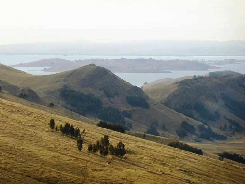
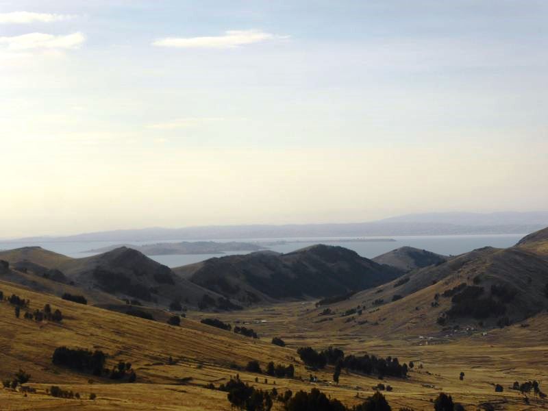
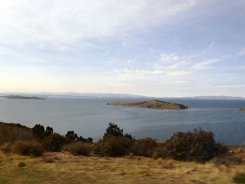
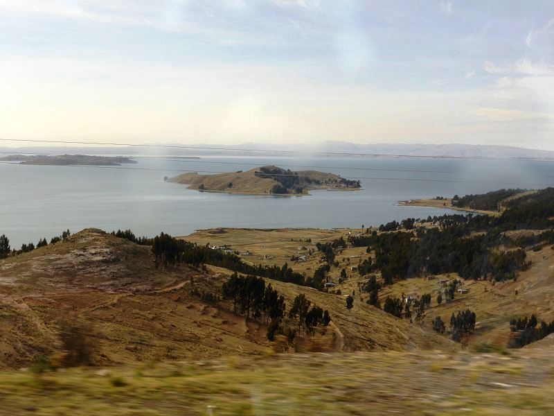
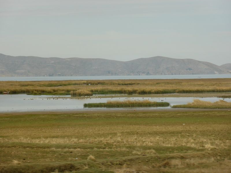
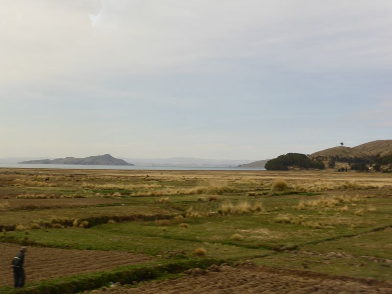
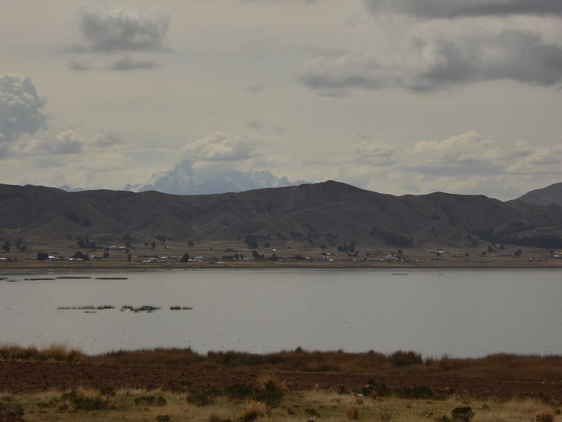
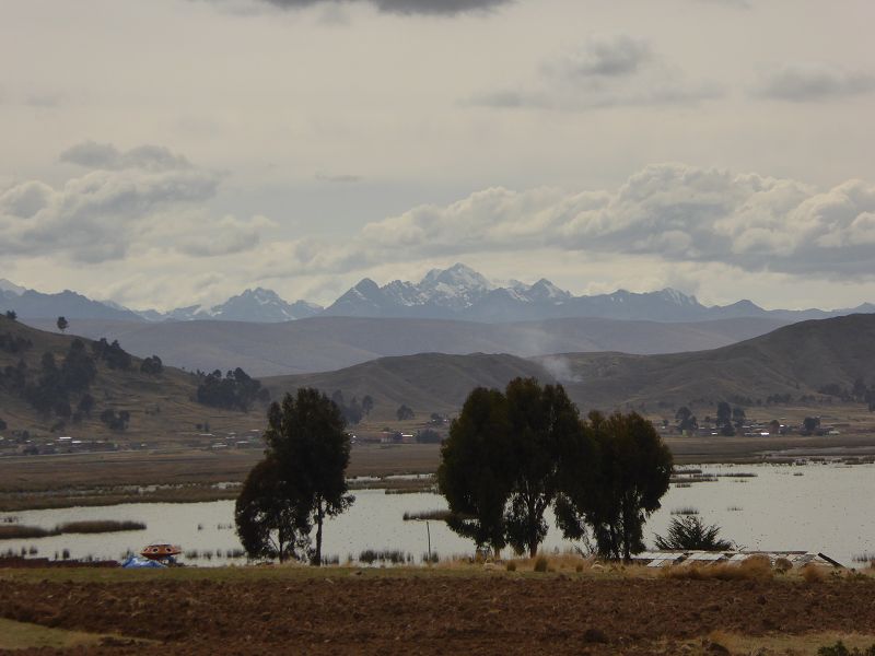
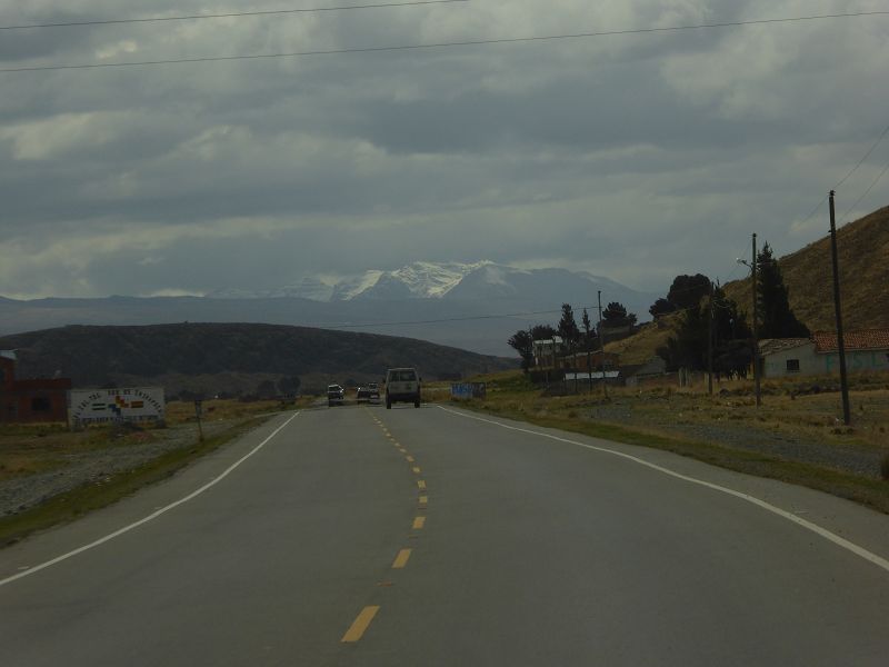
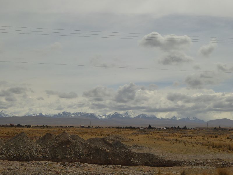
Estrecho de Tiquina (Tiquina Strait) is a narrow body of water
that separates Lake Titicaca
into two parts: the southern
and northern sections.
It is located in Bolivia,
between the La Paz and
Copacabana regions, and
serves as an important natural and geographical feature in the
Titicaca Basin.
Key Features of
Estrecho de Tiquina:
-
Geographical Location:
- The
Tiquina Strait
is situated at an altitude of around
3,800 meters (12,500
feet) above sea level, in the
Andean mountain range.
- The strait divides the
Titicaca Lake
into two parts:
- The
southern part
near La Paz,
which is the deeper and larger section of the lake.
- The
northern part,
which is shallower and more concentrated around
Copacabana.
-
Importance for
Transportation:
- The
Tiquina Strait
plays an essential role in the transportation system of
Lake Titicaca,
as it provides the easiest crossing point between the southern
and northern sections of the lake.
- A ferry service operates
here, transporting both passengers and vehicles across the
narrow strait. Visitors traveling between
La Paz and
Copacabana
typically cross the Tiquina Strait by
boat or
ferry.
-
Scenic Beauty:
- The
Tiquina Strait
offers beautiful views
of the surrounding
Andean mountains, and the
clear waters
of Lake Titicaca.
It’s a picturesque location for
photography
and sightseeing.
- The area surrounding the
strait is tranquil, with
small fishing villages
on both sides, giving it a charming and serene atmosphere.
-
Cultural Significance:
- The Tiquina Strait and
Lake Titicaca
have a deep cultural
and historical significance for the indigenous
communities in the region, especially the
Aymara people
who have lived around the lake for centuries.
- The lake and its
surroundings are believed to be the
birthplace of the Inca
civilization, making the area an important site in both
indigenous folklore
and archaeology.
-
Wildlife:
- The waters of
Lake Titicaca
are home to various species of
fish, such as
the Titicaca water
frog and
native fish species like
karachi and
trout.
-
Birdwatching
is also popular, with the lake being a habitat for
waterfowl and
migratory birds.
-
Tourism:
- The crossing of the
Tiquina Strait
is often included in travel itineraries for visitors to
Copacabana
and Lake Titicaca.
It provides a glimpse into the
rural life of
the region and is a highlight for travelers heading to
Isla del Sol
or Isla de la Luna,
both of which are significant
Inca archaeological
sites.
- The journey through the
strait offers a peaceful transition between the
mountainous
and lakefront
landscapes of the region.
-
Tiquina Ferry:
- There are
two ferry boats
that carry passengers and vehicles across the strait, and they
are an integral part of travel in the region. For passengers, it
is a short ride that typically takes around
15 to 20 minutes,
depending on weather conditions and boat traffic.
- The crossing is often a
unique experience for tourists, providing a chance to take in
the stunning landscapes and observe local life.
Things to Do Near
Estrecho de Tiquina:
-
Visit Copacabana:
A popular town on the shores of Lake Titicaca, famous for its
religious festivals,
especially the Fiesta de
la Virgen de la Candelaria.
-
Isla del Sol: A
stunning island in Lake Titicaca known for its
Inca ruins,
including Temple of the
Sun, and its
beautiful landscapes.
-
Isla de la Luna:
Another island on the lake that is often explored as part of a tour,
offering Inca ruins
and scenic views.
-
Hiking and Photography:
The region around the Tiquina Strait and Lake Titicaca offers
various hiking
and photography
opportunities, with its unique landscapes, traditional communities,
and ancient ruins.
-
Boat Tours: Many
visitors take boat tours around
Lake Titicaca,
offering opportunities to explore remote islands and
indigenous villages.
Practical Information:
-
How to Get There:
The Tiquina Strait is located on the route between
La Paz and
Copacabana, so
visitors can easily reach the area by bus or car. The ferry crossing
is a regular part of the trip for those traveling between the two
destinations.
-
Best Time to Visit:
The dry season
(from May to September)
is the most favorable time to visit, as the weather is cooler and
drier, making for a more comfortable experience. The
rainy season
(from December to March)
can lead to occasional disruptions, particularly in rural areas.
Summary:
The
Estrecho de Tiquina
is a significant and beautiful part of
Lake Titicaca,
providing a stunning crossing point between the southern and northern
sections of the lake. The strait is important for both transportation
and tourism, offering visitors a scenic glimpse of Bolivia’s highland
landscapes, traditional Andean life, and the natural beauty of
Lake Titicaca.
Whether you're crossing the strait on a ferry, exploring nearby towns
like Copacabana, or
visiting nearby islands, the Tiquina Strait is a key highlight in any
Bolivian adventure.
|
 Safaris
Bergsteigen
Wandern
Inselwandern Weltweit
Safaris
Bergsteigen
Wandern
Inselwandern Weltweit
 Chronologie
Inselwandern
Chronologie
Inselwandern Europa
Inselwandern
Europa
Inselwandern
 Städtewandern
 Paintings
 Dirk Rauschenbach